The first day proceeds as I expect. Making for Cleator, I walk almost six miles, a little more than a Stone Mountain circular. Wanting to break-in the legs, I walk in sunshine through a woodland timber area, pastures with sheep munching the grass.
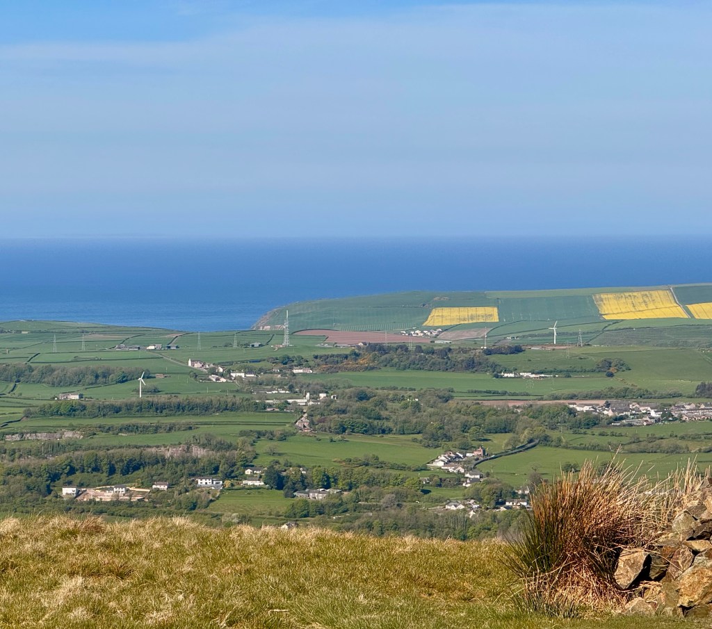
Miscalcuting the distance to Ennerdale Bridge, my second day is also an easy, enjoyable day. The mileage is a tad less than seven miles with only one major hill, Dent Hill. The views from Dent Hill are wonderful. Looking back toward St Bees, I can see the coast and the Isle of Man; looking forward, I have my first look of the Lake District mountains. Nice.
The third day from Ennerdale Bridge to Seatoller differs. At breakfast that morning, everybody is chatting about which route they’ll take, the standard route or the high route. Only one fellow, Fred, decides to take the high route. The other four couples are taking the standard route. The seven hour, eleven mile standard route reaches Honister Pass before dipping down to Seatoller. The eight-and-a-half hour high route allows one to visit Red Pike and three other summits before emerging at Honister Pass.
I decide to walk the high route. Because I want to see the Lake District by looking down at the lakes, and because rain is moving in for an undetermined number of days, I’ll take the high route. Delaying until three o’clock, the expected rain shouldn’t hit me on the high route. Hopefull thinking.
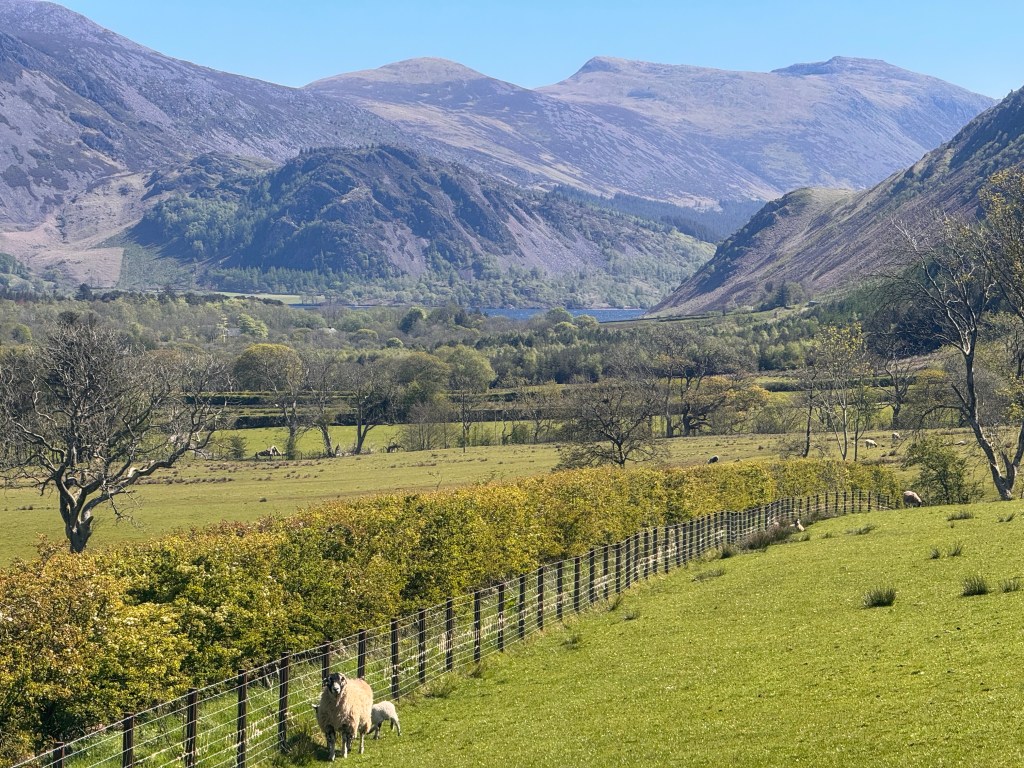
Fred and I start shortly after 8AM at a brisk pace. Beautiful walk around the north side of Ennerdale Water. On the other side of the water is Robin Hood’s Chair, a rocky outcrop rising from the lakeshore.
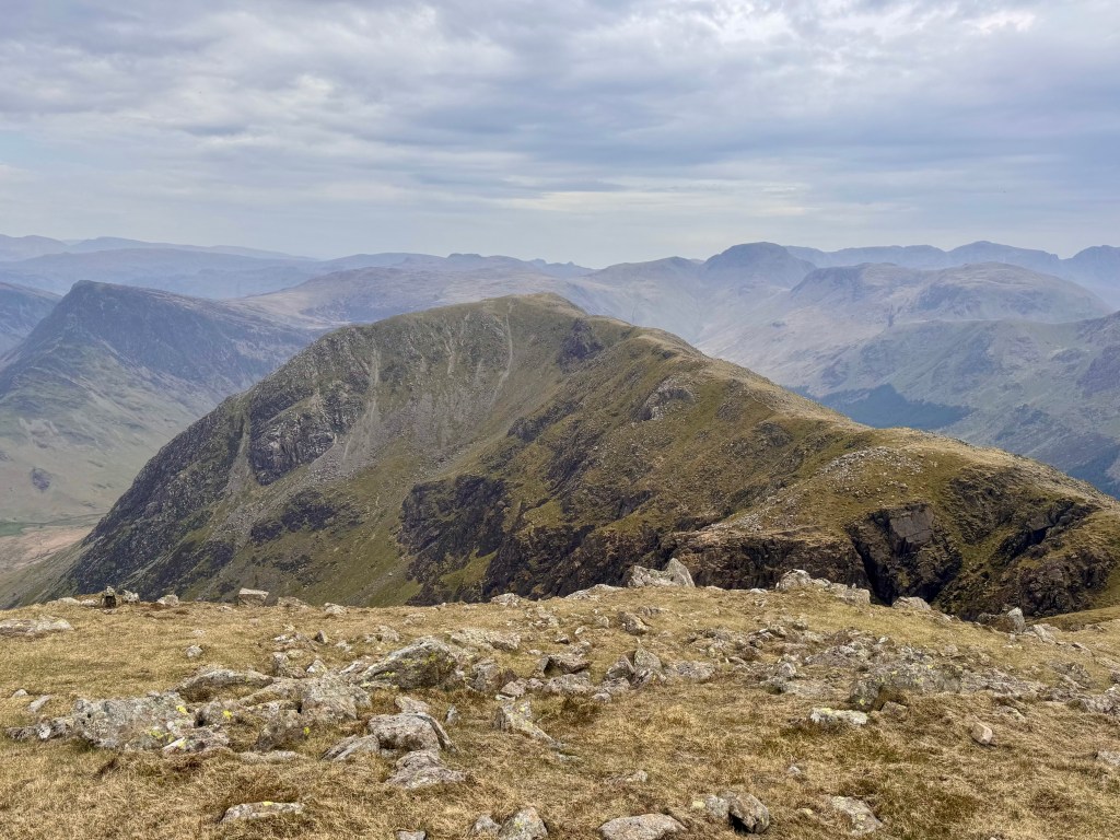
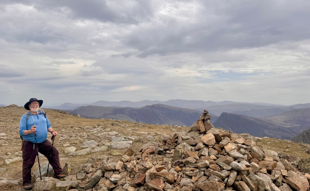
We arrive at the cutoff. We start climbing, and climbing, and climbing. Our first destination is Red Pike. I learn that the English don’t believe in switchbacks. The trail, as long as we can distinguish one, goes straight up, until it disappears. We are in open mountain side, grass, rocks, and sheep. So, we simply follow sheep paths and an occasional rocky cairn to guide our way. We can’t get misdirected as long as we head up and join the ridge line trail. Oh, I forget to mention that Fred, from Luxembourg, runs marathons and is probably 6’2”. In ten minutes, he is ahead of me. The last I see of Fred is when he reaches the ridge line, waves, and disappears. I’m probably half-way up the 2000 elevation gain to that ridge line.
As I near the ridge line trail, I see my first other hikers. A couple is heading west down from Red Pike; another couple is heading east. When I’m in unfamiliar territory, breathing hard, not sure what is around the corner, it is nice to see other folks even if they are at a distance.
I hike along the ridge line for a good hour or two. Talking with several other folks. None of them are heading to Honnister Pass. When I say my destination is Seatoller through Honnister Pass, one fellow says “Really?” Hmmm.
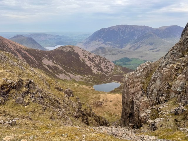
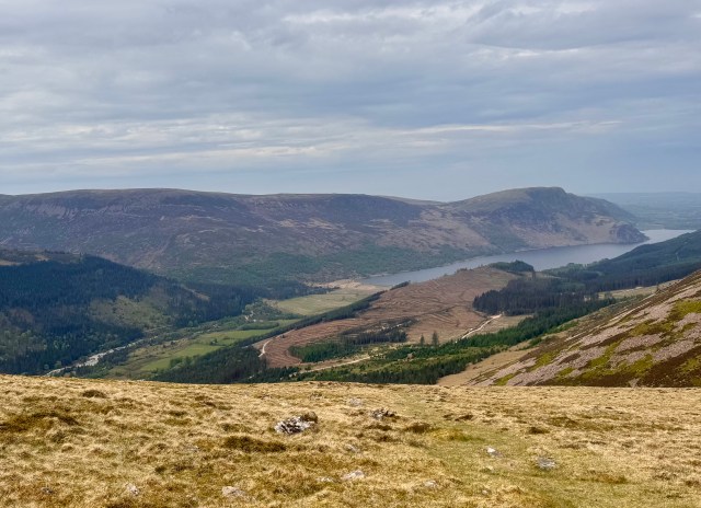
There are glorious views in every direction. Down to Ennerdale Water. Down to Dentwater. Peaks in every direction.During early afternoon, my water bladder goes dry. I think I need a better fuel guage. Also, the wind picks up and the rain begins to fall, earlier than I expected. Worse yet, it is a cold, hard rain. Not yet sleet, but almost.
I look ahead. Wainwright’s favorite fell (English parlance for mountain) is still ahead. And, of course, before climbing that mountain, the trail dips 500 feet before going back up another 750 feet. Ouch.
I talk to one couple who is taking a cut-off trail the opposite direction of my planned route. Familiar hikers of the area, they point to a trail that leads to Buttermere. Shortly later, I talk to another couple who are heading that way. Since I’m cold and my legs are getting stiff, I decide to leave the ridge line.
Of course, getting down is easier said than done. The hike down is as tough as the hike up. While this time there is a discernable trail, the trail is almost all rock. In fact, in one spot, the trail is rocky scree for two or three hundred feet, like walking downhill on a giant sand or gravel pile. I slide to my fanny twice, but nothing hurt. More treacherous is that the stone rocks, and even steps thoughtfully cut into the rock face of the mountain, are wet. All of us take it slow going down the face ofthe mountain.
I make it down. I make for some buildings where caravans are parked in an open field. Thankfully, there is a small shop. Since my destination is probably 5-6 miles away over Honnister Pass, I need to figure out how to get there. I ask the fellow at the counter “Do you know how I can make it to Seatoller?” “Sure, mate, a bus comes by here every thirty-minutes. The next one should be here in twenty minutes.”
Thank God! Around fourteen miles. An elevation gain of four-thousand feet, and almost the same descent. And, when I get to Glaramara, my night’s lodging, certainly an Ibuprofen!
